Geography

In News: The assured depth dredging work of river Barak (NW-16) from Badarpur to Bhanga (10.5 km) has been awarded to Dredging Corporation of India.
- Funds have been disbursed by the World Bank to improve the waterways in Assam
Barak River:
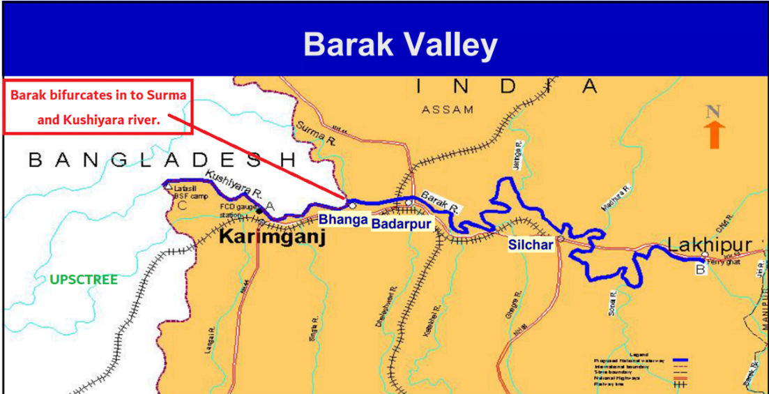
- Barak rises in the Manipur hills and enters the plains near Lakhipur, Assam
- The river enters Bangladesh as Surma and Kushiyara.
- Later, the river is called the Meghna and receives the combined flow of the Ganga and Brahmaputra.
- The principal tributaries of Barak are the Jiri, the Dhaleswari, the Singla, the Longai, the Sonai and the Katakhal.
- The Barak sub-basin drains areas in India, Bangladesh and Burma.
- The drainage area lying in India is 41723 sq.km which is nearly 1.38% of the total geographical area of the country.
- It is be on the north by the Barail range separating it from the Brahmaputra sub-basin, on the east by the Na Lushai hills and on the south and west by Bangladesh.
- The sub-basin lies in the States of Meghalaya, Manipur, Mizoram, Assam, Tripura and Nagaland.
- The hydropower potential of the basin is 2042 MW at 60% load factor.
Source: PIB


