TLP-UPSC Mains Answer Writing

SYNOPSIS: IASbaba’s TLP – 2018: UPSC Mains General Studies Questions [27th June 2018]- Day 3
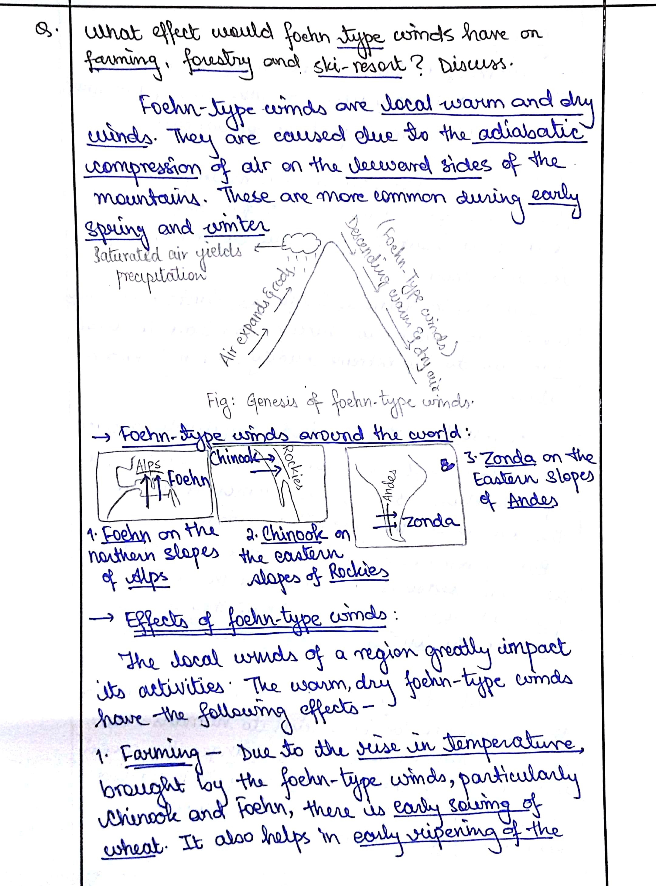
1. What effect would foehn-type winds have on farming, forestry and ski-resorts? Discuss.
Approach:
- Introduction: Mention what is Foehn wind and types.
- Body: Use those three areas mentioned in question and give one positive and one negative point for each part. Include diagram to score extra marks.
- Conclusion: 2-3 lines conclusion is must.
Answer:
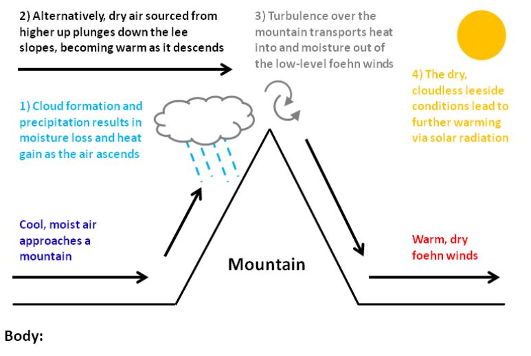
Foehn wind is a warm, dry and down-slope wind occurring on the leeward side of a mountain as a result of the adiabatic warming of the air descending after precipitating on the windward slope of the mountain.
Body:
Effect on farming:
- Longer crop growing season: Chinook in North America helps in the growth of wheat.
- Droughts and drying up plants in certain areas.
- Favorable to cattle: Melts snow early and allows longer access to Alpine pastures for cows and sheep.
- Only crops with less water requirement can be grown due to low rainfall.
Effect on forestry:
- Forest fires: Santa ana winds in California are responsible for wildfires every year.
- Lack of dense forests and thus less forest associated activities in the region.
- New Farm land: Helps in clearing forest and preparing land for farming activities.
Effect on ski-resorts
- Avalanches: Loosening of ice particles due to melting.
- Glacial melt and downstream flooding can affect infrastructure.
- Health impacts decrease tourist attraction of the resorts.
Conclusion:
The foehn-type winds are found across all continents and are known by their regional names like Khamsin in Middle east, Nor’wester in New Zealand and foehn in Europe. Its effects can be both favorable and unfavorable, depending upon the prevalent climate of the region.
Best answer: Ankita Jeph
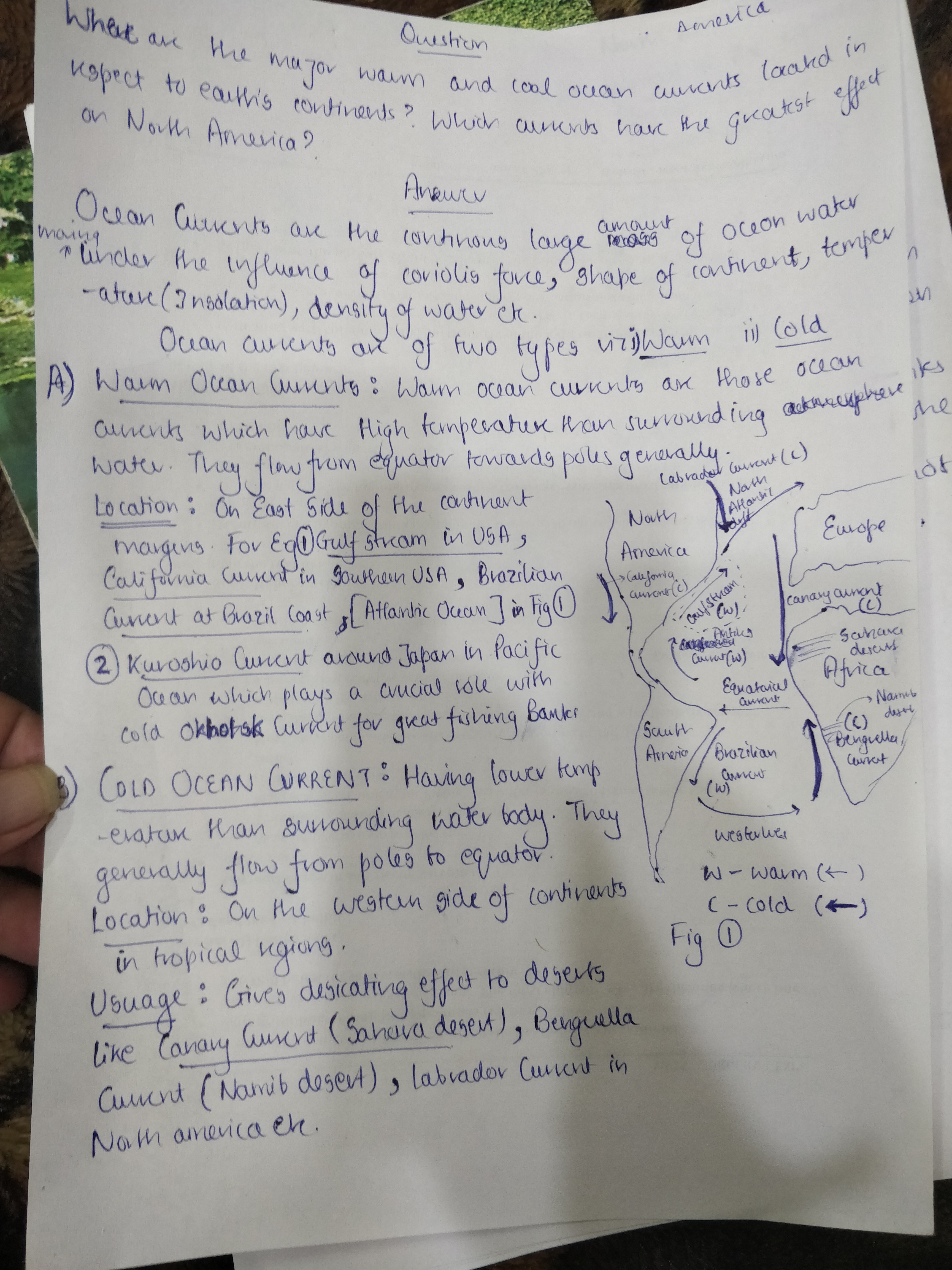
Q2. Where are the major warm and cool ocean currents located in respect to Earth’s continents? Which currents have the greatest effects on North America?
Approach:
-
- Define ocean currents and their types briefly.
- Elaborate the types with a diagrammatic representation.
- Discuss briefly about the current’s greatest effects on North America.
Answer:
Ocean currents are like river flow in oceans, representing a regular volume of water in a definite path and direction. Based on temperature, they are classified as a) Cold/cool currents: bring cold water (higher to lower latitudes) into warm water areas and b) Warm currents: bring warm water into cold water areas.
Cold currents: These are usually found on the west coast of the continents in the low and middle latitudes (true in both hemispheres) and on the east coast in the higher latitudes in the Northern hemisphere. Some of the major cold currents are:
Warm currents: These are usually observed on the east coast of continents in the low and middle latitudes (true in both hemispheres) and on the west coasts of continents in high latitudes.
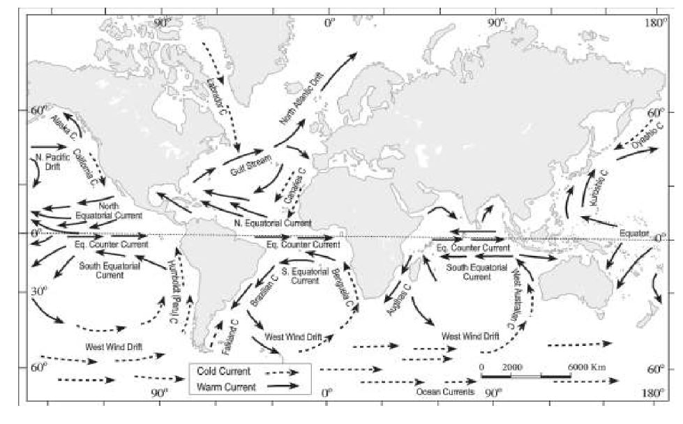
The ocean currents having the greatest effects on North America are:
- Labrador and Gulf stream:
The mixing of both the cold and warm currents leads to replenishing of plankton at the surface waters off Newfoundland coast resulting in one of the world’s best fishing grounds and foggy conditions as well.
Gulf Stream helps in keeping the ports ice free to a certain extent and augments precipitation as well.
- Alaska current:
Helps in keeping the ports along the western coast ice free, due to warming effect.
- California current:
Due to desiccating effect, results in the dryness along the western California region I.e., Mojave Desert.
Thus, apart from balancing the thermal distribution over the latitudes, ocean currents play a very critical role in shaping the climate of region and affecting social and economic life of people.
Best Answer:
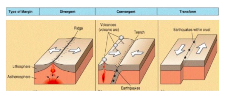
3. How does the formation of the Hawaiian Islands support plate tectonics theory? Discuss.
Approach
- Give a brief introduction about Tectonic Theory.
- Explain briefly the plate tectonics. Explain the formation of Hawaiian Islands with the help of hotspot theory.
- Connect the two concepts to show the link.
- Diagrams are necessary in such questions.
Introduction
Plate Tectonic refers to a theory which states that the Earth’s crust is divided into many mobile plates which float over the asthenosphere. The theory has been put forth to explain the creation and destruction of landforms across the globe.
Body-
According to the theory, the plates are in constant mobility at very slow pace. The presence of fold mountains, oceanic ridges have been considered as the testimonial for this theory. The structure and formation of Hawaiian Islands itself is considered to be an evidence of plate tectonic theory.
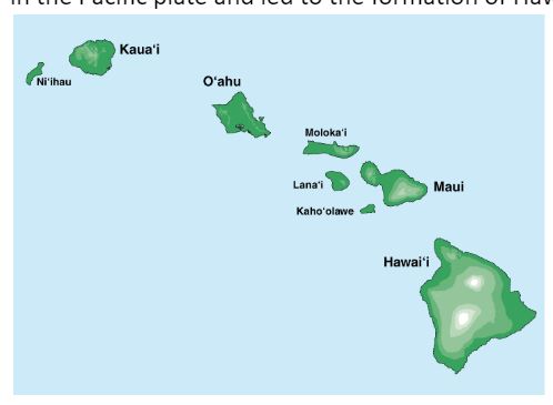
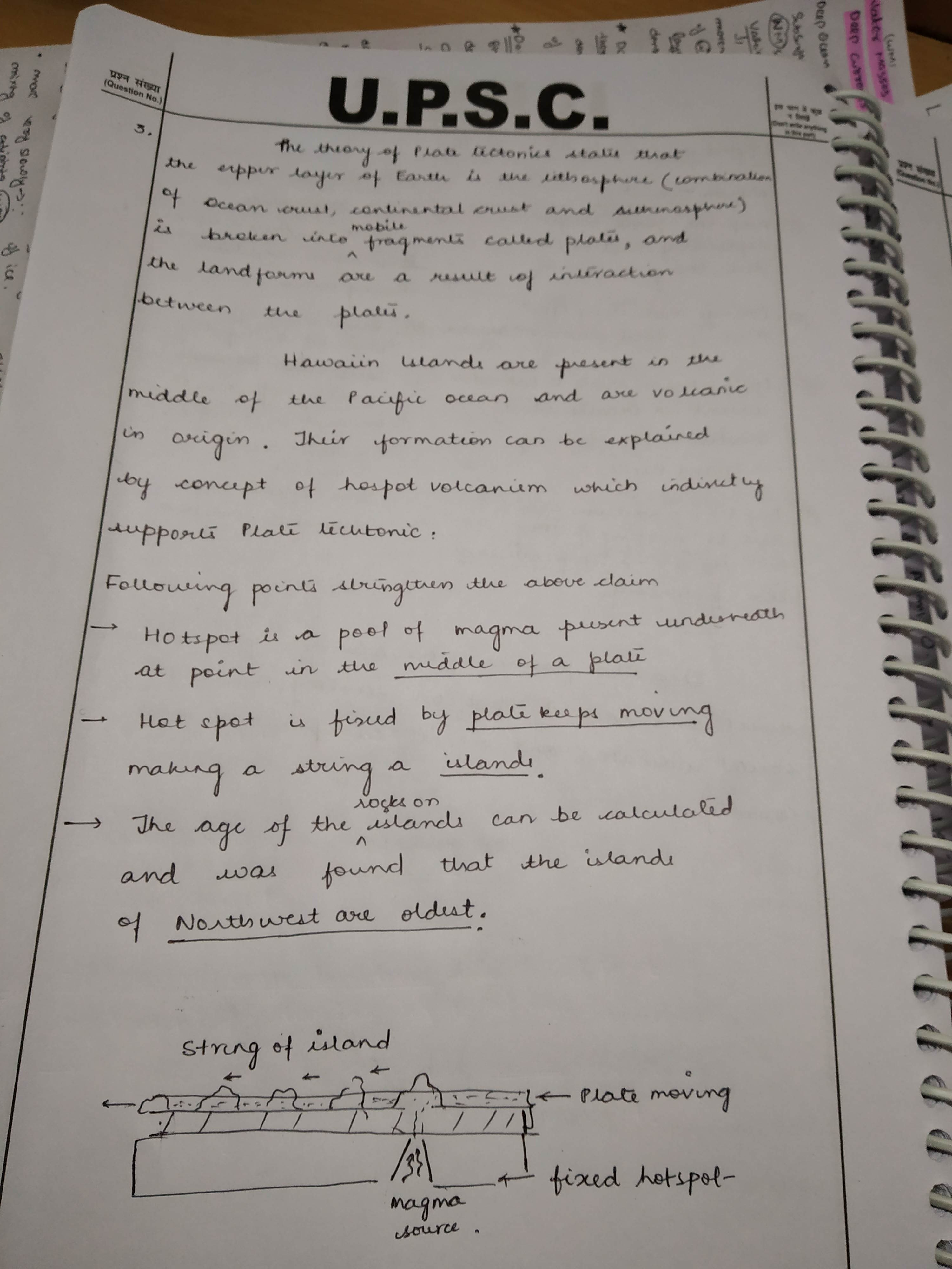
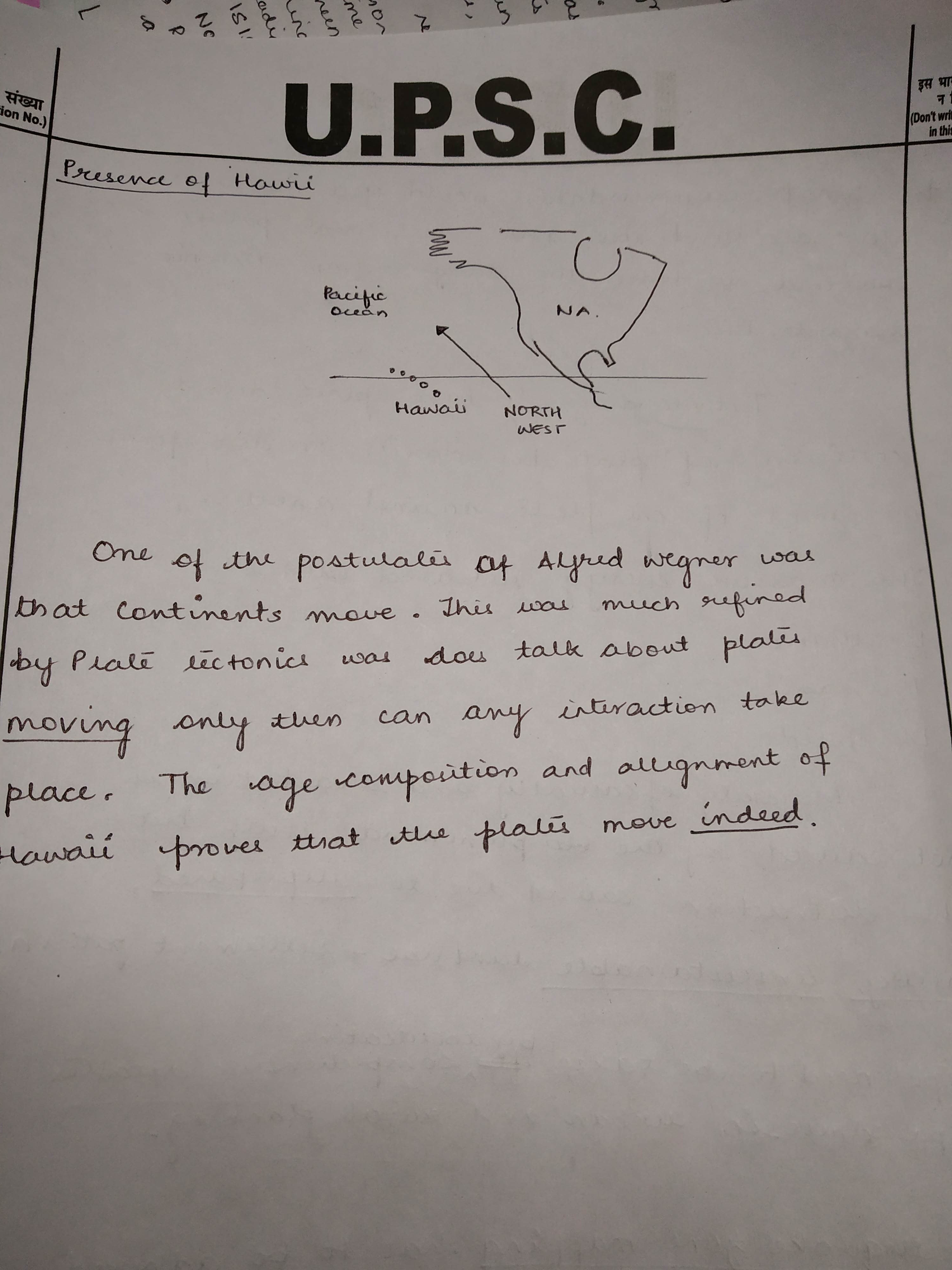
The Hawaiian Islands are an archipelago of eight major islands, several atolls in the North Pacific Ocean. The islands are spread out from South Eastern to North Western direction.
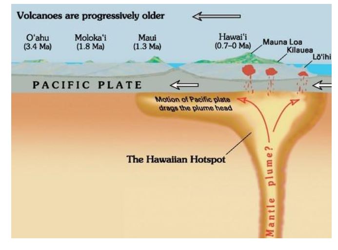
The Islands have been formed due to hotspot volcanism. Hotspot vulcanism occurs when the unusually hot magma flows towards the surface of the lithosphere. Due to its high temperature, it creates pressure on the plate, which ultimately cracks leading to volcanic eruption. This process leads to the formation of volcanic mountains, which can under sustained pressure rise to great heights. A similar process occurred in the Pacific plate and led to the formation of Hawaiian Islands.
But as the above image shows the Hawaii is in the form of string of islands. Their age is gradually increasing from south eastern direction. Given the fact that, the region of hotspot remains constant, the only way such string of islands would have been formed is due to the movement of the plate above. This certifies the fact the Pacific plate has been moving and in the North Western direction.
Conclusion:
Thus, the genesis, direction and age of the Hawaiian Islands prove that they were formed while the Pacific plate was moving. This movement confirms the plate tectonic theory which is central to many geological observations.
Best Answer: vipasha parul
4. What recommendations would you make as far as land use and settlement patterns are concerned to lessen the danger from tectonic hazards? Discuss.
Approach:
- Introduction- Explain what constitutes tectonic hazards.
- Main body- How properly planned land use and settlement patterns can help lessen the danger of tectonic hazards.
- Conclusion
- 1-2 diagrams (rough sketch only) should be drawn as the question is from geography.
Introduction:
Tectonic hazards are hazard events caused by tectonic plates colliding into each other, moving against each other, moving apart or subduction between plates. Examples of tectonic hazards includes earthquakes, landslides, tsunamis and volcanic eruptions.
Recommendations:
Land use planning is a major tool for reducing risks from natural hazards. Risk-based planning provides an opportunity to move beyond planning for a natural hazard only, to planning for the consequences of an event.
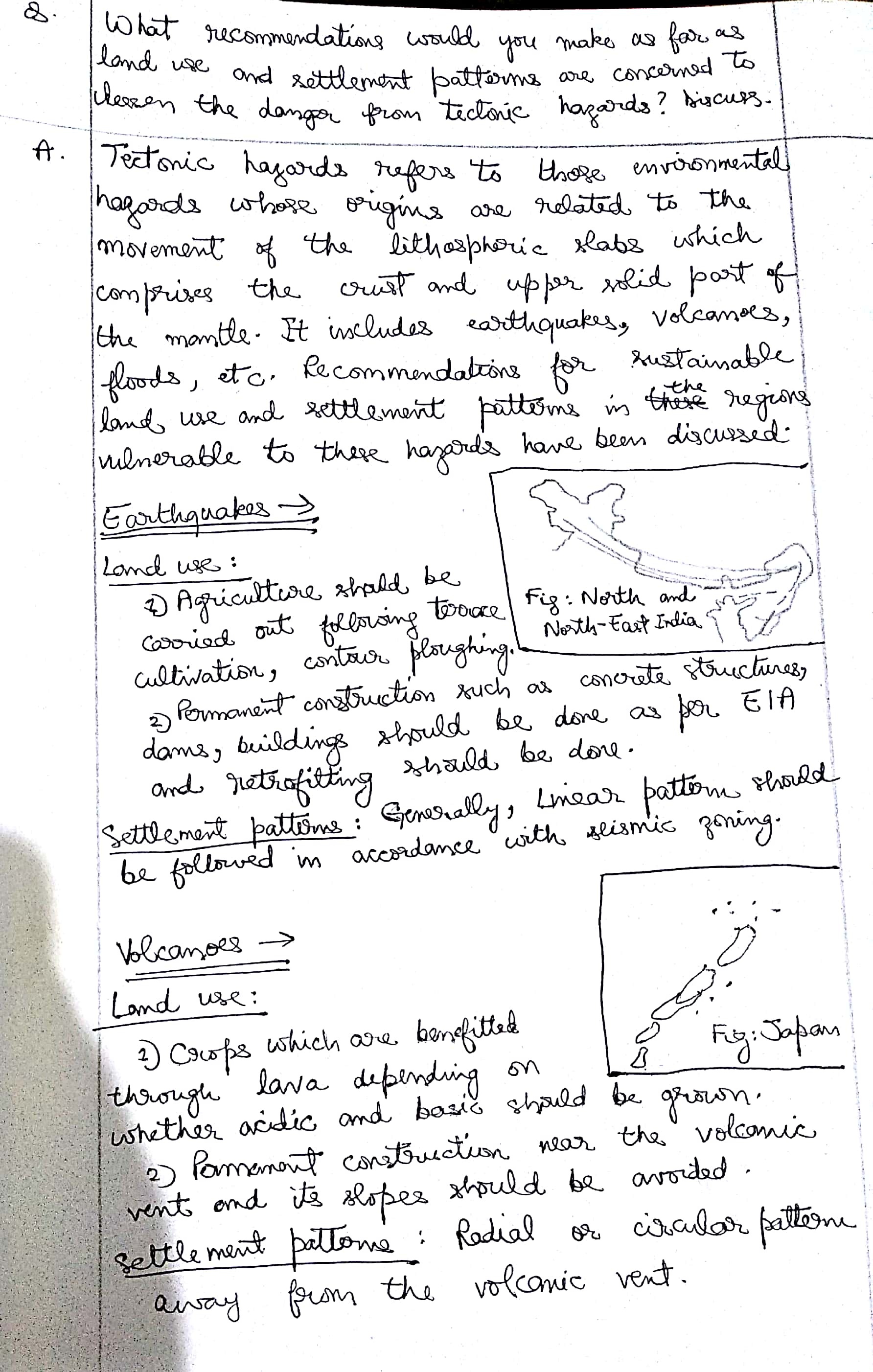
- Micro- Zonation of area on the basis of vulnerability in case/seismicity in case of earthquake- Delineation and demarcation of plate boundaries, plate margins and fault lines as these are the areas at risk. Any construction especially that of critical infrastructure like nuclear plants in these areas must be avoided.
- Earthquake resistant structures. Building materials used should be procured locally and construction should be based on factors like soil type (density and other factors) as well as local climate etc.
- Urban land use- Fragmented settlement to mitigate pressure on land, Evacuation zone. City expansion should be horizontal and not vertical. Further restoration work (removing or strengthening of vulnerable structures) within the city should be a continuous exercise. Parkland, shelter belts and open spaces should be an important part of city plan.
- Rules and regulations related to land segregation, zonation, building height etc. should take into account regional variation and should be implemented strictly. Zero tolerance toward illegal construction, high rise buildings etc.
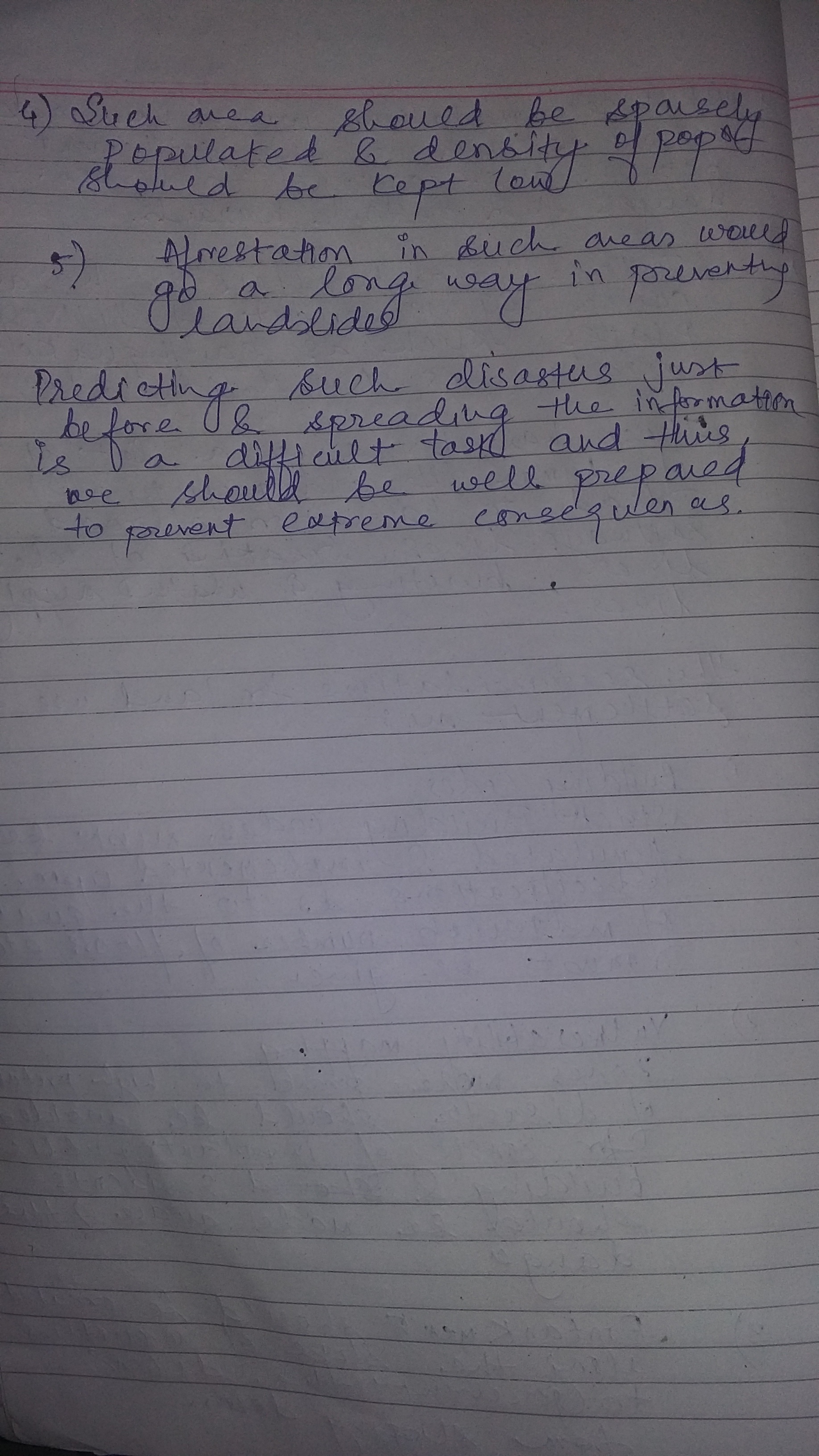
- Landslides-
Afforestation in mountainous region to decrease the risk of landslides. Land use should be such that plains should be used for settlement, slopes with little inclination should be used for agricultural activities and higly inclined slopes should be covered with trees. - Tsunamis-
Rezoning of low-lying coastal land at risk from tsunamis, in association with the structural strengthening of buildings, can be an effective defence. - Sustainable land use- agricultural practices, land mining, extraction of resources etc should be sustainable. Ground water should be used judiciously.
Apart from above awareness among local population, early hazard warning systems etc can help handle the hazard by decreasing the vulnerability.
Conclusion:
Disaster risk reduction (DRR) is an integral part of social and economic development. And from above it can be concluded that land use planing is potentially powerful mitigation tool in case of natural hazards.
Further, as recognized under the Sendai Framework, though the State has the primary role to reduce disaster risk, the responsibility should be shared with other stakeholders including local government and the private sector. Empowering local government with the help of private sector (CSR, NGOs) can go a long way in making the population less vulnerable to hazards.
Best answer 1: Rohan
Best answer 2: Happy
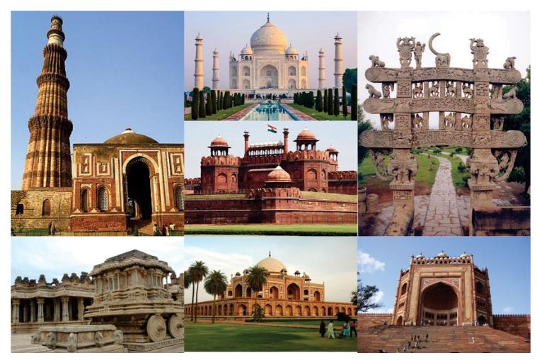
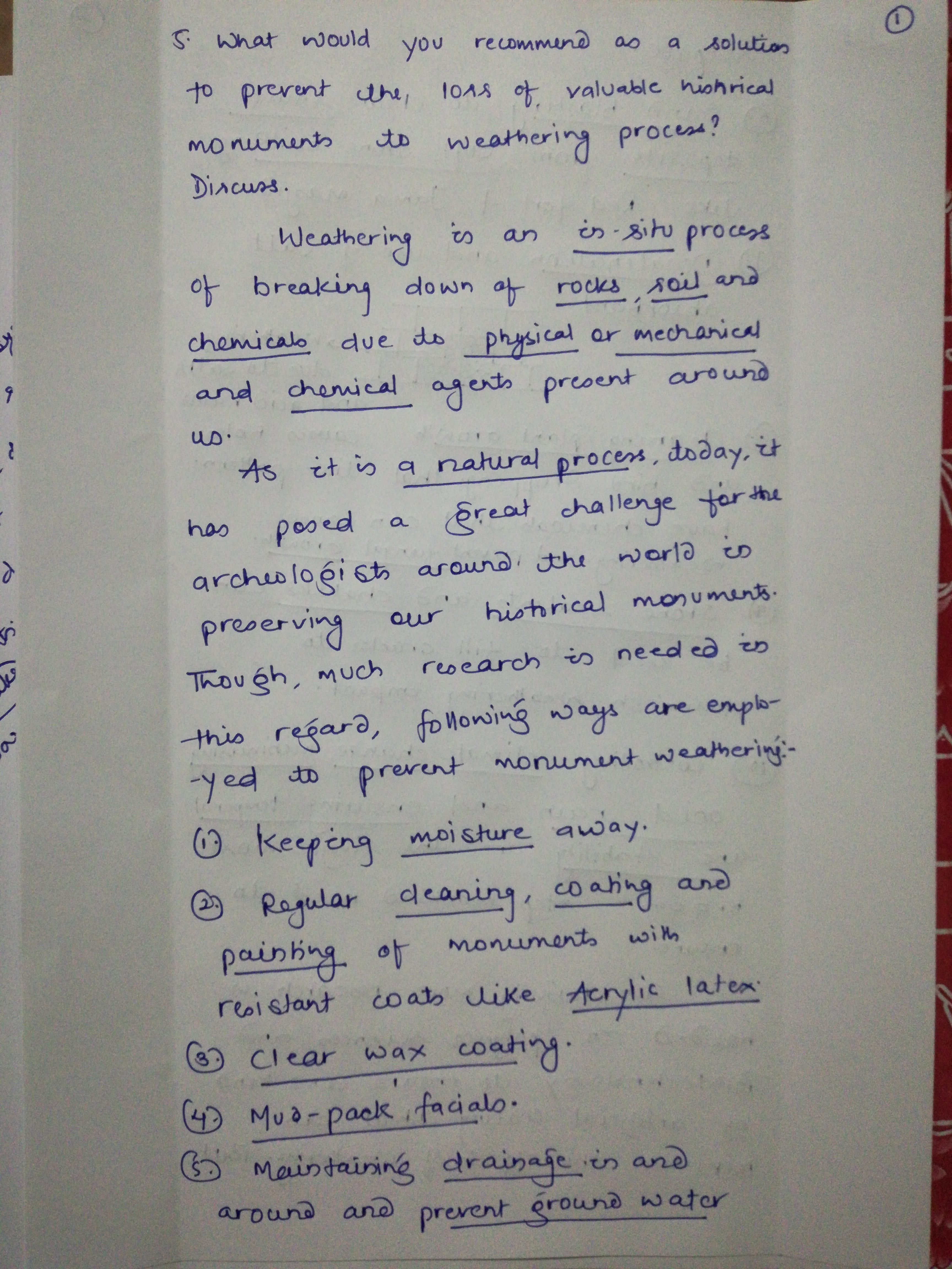
5) What would you recommend as a solution to prevent the loss of valuable historical monuments to weathering process? Discuss.
Body:
India is an old country, and is fortunate in having the remains of large numbers of buildings that, considered together, provide us with the most tangible and illuminating insights into our past. Most of these buildings are structurally complete and remain in use, even if they have had to be periodically modified to meet changed requirements.
If we ever inspected a crumbling gravestone or once-engraved stone pillar now worn smooth, we can see what weathering can do to even the strongest materials. This weathering occurs on a larger scale as well, affecting some of the world’s most famous monuments. Without human intervention, weathering reclaims monuments, wearing them down to scraps of rock and soil over time. Protecting stone monuments requires on-going preservation efforts, leaving man in constant battle with Mother Nature.
- Marble statues and limestone structures, including many of India’s finest buildings from the middle Ages, are being eaten away, molecule by molecule. Acid rains from coal- or oil-fired engines and manufacturing plants have caused much of the damage.
- Over the years, preservationists have tried to ward off the harm with various remedies, many of which break down in sunlight or water.
- Now, the Sandia National Laboratories scientists hope they have the answer, which also will help prolong the life of concrete used to entomb atomic waste, in a concoction they brewed during three years of research.
Different types of weathering can be seen:
- Mechanical
- Chemical and
- Biological
After surveying by the geologists of natural and man-made damage, including explosions and partial demolition, researchers are suggesting that the monuments may be undergoing continuous damage due to environmental pollution. There is evidence that air pollution has caused substantial harm to monuments of many parts of the world. For e.g. Taj Mahal
Solution to prevent the loss of valuable historical monuments:
- Apply a stone-sealer to buildings with a stone exterior. Stone, some types more than others, can be very porous and therefore vulnerable to moisture. Stone-sealants help protect stone from unwanted moisture than can lead to cracks and mold.
- Fill in any gaps or cracks in the building with caulk to prevent air leaks that can lead to unwanted moisture entering into the building. This will help prevent wood siding from rotting; mold from entering into the building’s interior and cracks from forming.
- Buildings and statues constructed of limestone can be protected from pollution by applying a thin, single layer of a water-resistant coating, according to new research.
- Researchers developed a new way to minimize chemical reactions that cause limestone buildings to deteriorate.
Concerns of preservationists:
The biggest concern of many preservationists is that despite accelerated weathering tests, the long-term effects of consolidants in the real environment are hard to predict. And one of the most promising developments of stone preservation today was that advanced tests were increasingly being brought to bear on stone that has been consolidated and then weathered.
Best Answer: Abhishek singh


