- Home
- Daily Free Initiatives
- PYQs
- Courses
- Integrated Learning Program (ILP) – 2027
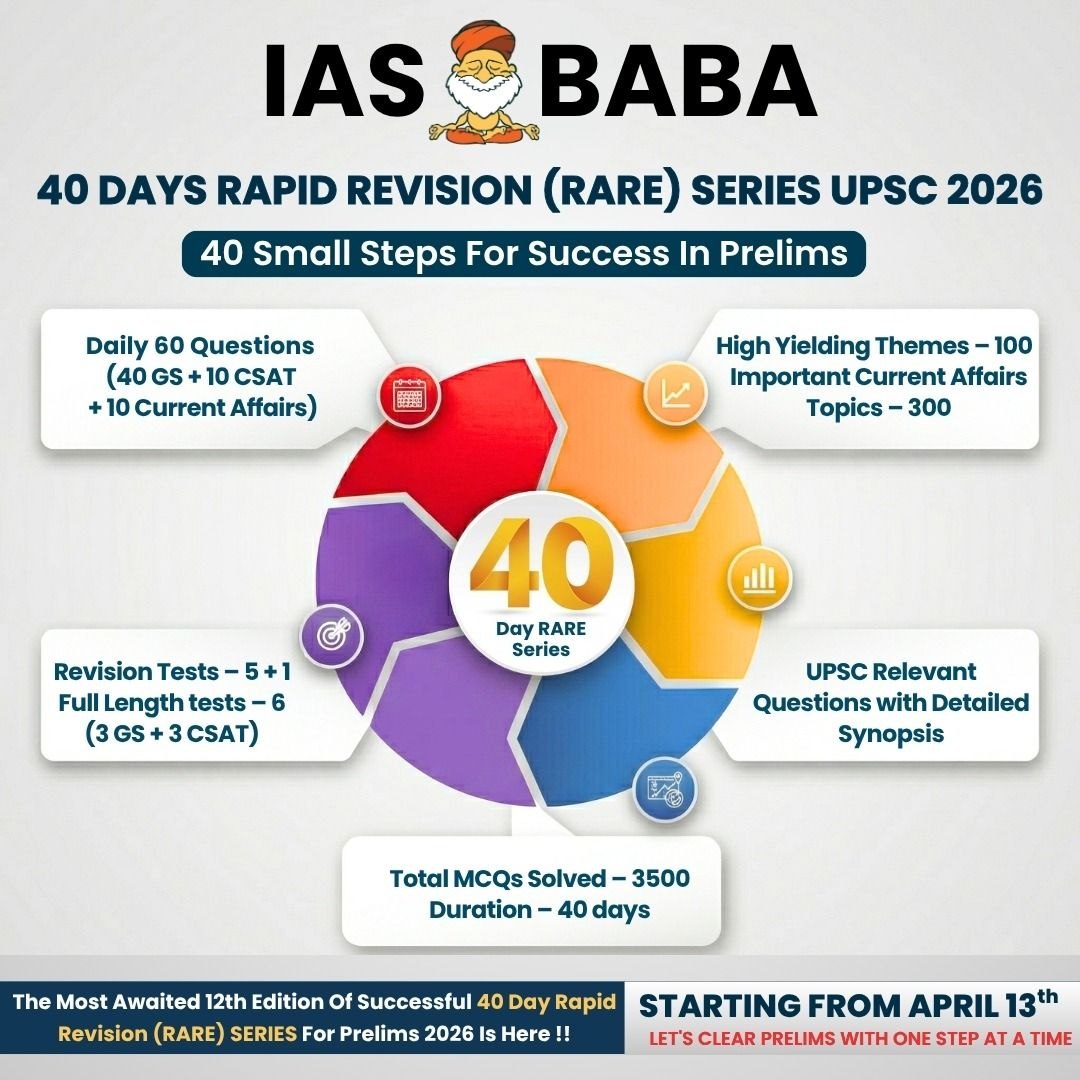
- 60 Day – Rapid Revision (RaRe) Series – 2026
- CSAT Mastery – 20 Days’ Smart Practice Programme
- SUPER 50: 1:1 Mentorship Programme Under Mohan Sir
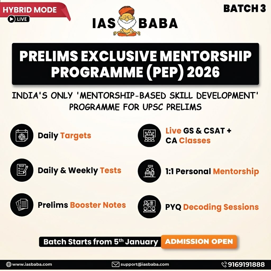
- Prelims Exclusive Mentorship Programme – PEP 2026
- Think Learn Perform (TLP) Connect for UPSC 2026
- Baba’s Gurukul Course – 2027
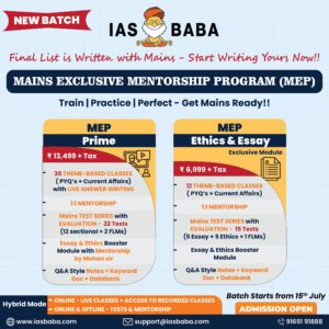
- UPSC 2025 Mains
- Optionals
- KPSC / KAS
- Centres
- Contact Us