Governance
In News: PM Modi unveils inland waterways projects worth over Rs 1000 crore to increase transport, trade & tourism in eastern India.
- He flagged off World’s Longest River Cruise-MV Ganga Vilas at Varanasi.
- Declared that this is the decade of transformation of infrastructure in the country.
Potential of Waterways in India
India has great potential in waterways transport. In 2014 there were only five waterways in the country now this number is 111 and around two dozen are functional and transportation of cargo has increased triple times.
The inland water transport is a cheap, fuel-efficient, environment-friendly mode with a higher employment generation potential and is suitable for heavy and bulky goods. But, the share of inland water transport in total transport in India is only around 3.5 per cent.
Status of inland water transport:
- The Government of India is working to develop inland waterways as an alternative mode of transport in the country, which is cleaner and cheaper than both road and rail transport.
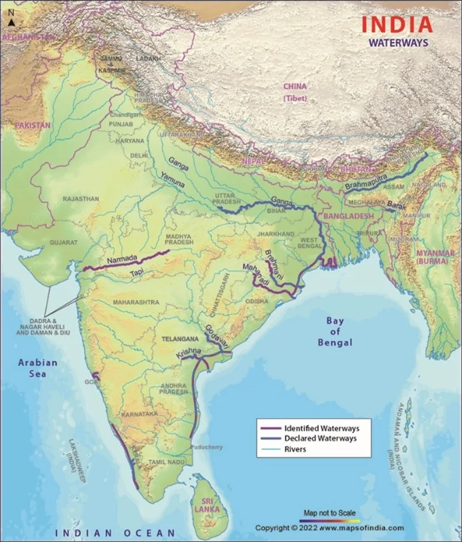
- There are 111 National Waterways in the country today, after 106 waterways were declared as National Waterways, adding to the list of 5 existing NW, in 2016. Some of the National Waterways in the country are already operational/navigable and are being used for transportation. Some of these include Ganga system, Brahmaputra system, etc.
- The Inland Waterways Authority of India (IWAI) is working on developing the new National Waterways and enhancing their navigational potential. As per the feasibility reports completed so far, 36 NWs have been found to be technically viable. Out of these 36 NWs, developmental activities have been initiated on the following 8 NWs in 2017-18.
Exploring the untapped potential:
- RIS (River Information system) has been implemented in some places where RIS is a combination of tracking and meteorological equipment with specialized software designed to optimize traffic and transport processes in inland navigation.
- Moving a step ahead towards ensuring optimum use of National Waterways, the Inland Waterways Authority of India (IWAI) also launched a portal LADIS – Least Available Depth Information System.
- The Jal Marg Vikas Project (JMVP), for capacity augmentation of navigation on National Waterway-1 (NW-1), has also been approved.
- New integrated systems are being developed wherein the waterway will form part of a larger multi-modal transport network having linkage with the Eastern Dedicated Rail Freight Corridor and also with the area’s existing network of highways.
Economic benefits due to expansion of waterways:
- A well-coordinated inland waterways network could bring a fundamental alteration in the logistics scenario of the country. It represents a ready-built infrastructure network, which can be utilised without any further capital investment.
- Waterways do not involve challenges associated with land acquisition, which has always been a sensitive issue, causing time and cost overruns of numerous projects. The significant investment which India needs to build its roads/highways infrastructure network can be conserved through increased utilisation of the waterways.
- Waterways are a cheaper mode of transportation vis-à-vis the available alternatives, significantly reducing the point-to-point cost of goods transportation. As per a recent study of the Integrated National Waterways Transportation Grid, one litre of fuel will move 24 tons through one kilometre on road, 95 on rail and 215 kilometres on inland water transport.
- Movement of goods and passengers through inland waterways would necessitate setting up large number of landing and loading/unloading points. This has the potential to open up large and accessible hinterland for supply of goods which can be transported at a lower cost.
Implementation of the national waterways network is, however, fraught with challenges like –
- There is seasonal fall in water levels particularly rain-fed rivers of peninsular India which are almost dry during summer.
- Less flow of water due to diversion of water for irrigation. Hard for even steamboats to sail. Example: Ganga.
- Reduced navigability due to siltation, waterfalls and cataracts in rivers and salinity in coastal rivers.
- Dredging carried out to maintain a minimum depth of water may negatively affect the aquatic ecosystem, and entry of saline water into creeks in coastal areas.
- Lack of Public Funds: The financing requirement for NWs is huge and open-ended. Heavy investment will be needed to procure equipment, including dredgers, shipping vessels, and barges of different sizes.
- Disinterest by Private Players: Even after liberalisation and economic reforms, there has been very less active participation from private players in this sector.
- The channel draft of the national waterways is not uniform at 2 meters throughout the year, as is required. Some of these rivers are seasonal and do not offer navigability through the year.
- Around 20 out of the 111 identified national waterways have reportedly been found unviable.
- Further, all the identified waterways require intensive capital and maintenance dredging, which could be resisted by the local community on environmental grounds, including displacement fears, thereby posing implementation challenges.
Way Forward
- As every riverine system is unique and presents diverse challenges, separate studies based on a detailed micro-level review to assess viability need to be done for each, before taking up implementation.
- An effective waterways network would necessitate drawing up a well-coordinated strategy on lines of complementarity between the national network and other waterways, not declared as such, as well as between waterways and roadways/railways.
- The said strategy should closely look into the various undercurrents, including competing uses/needs, possible local resistance and also work closely and in coordination with local governments for quick and successful implementation of this important national project.

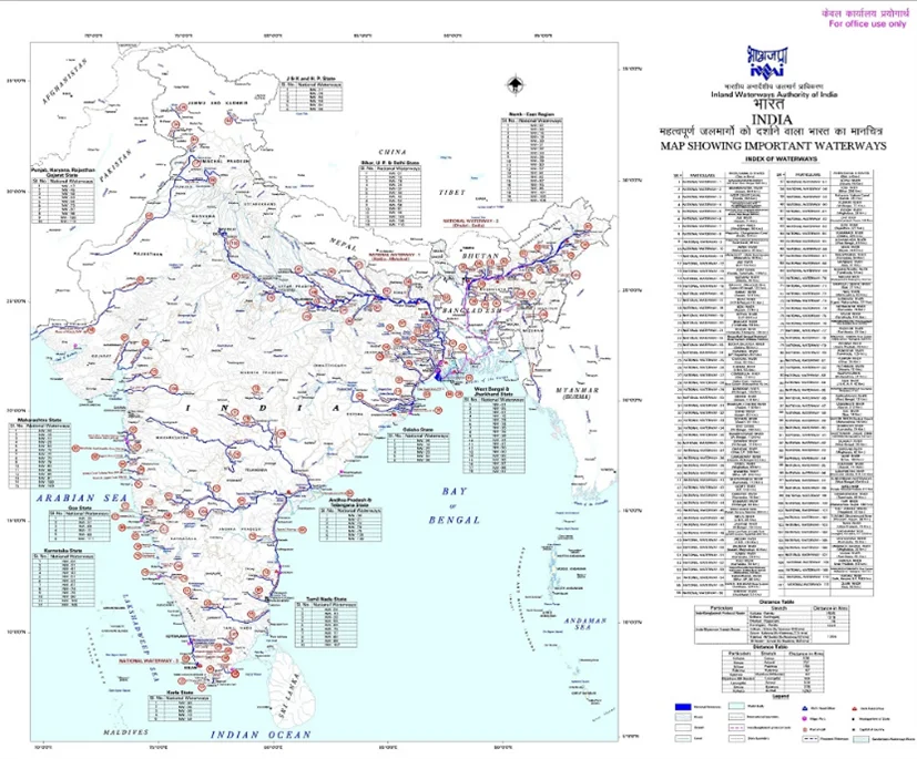
Map of important inland waterways [Source: Inland Waterways Authority of India]

Image source: Maps of India
Source:


