Part of: GS Prelims and GS II – Welfare schemes; E-Governance
In news: Recently, the Justice Department commemorated the milestone of crossing 9 lakh beneficiaries under its Tele-Law programme through Common Service Centres.
Common Services Centre (CSC) programme is an initiative of the Ministry of Electronics & IT (MeitY), that serves as the access points for delivery of various electronic services to villages in India
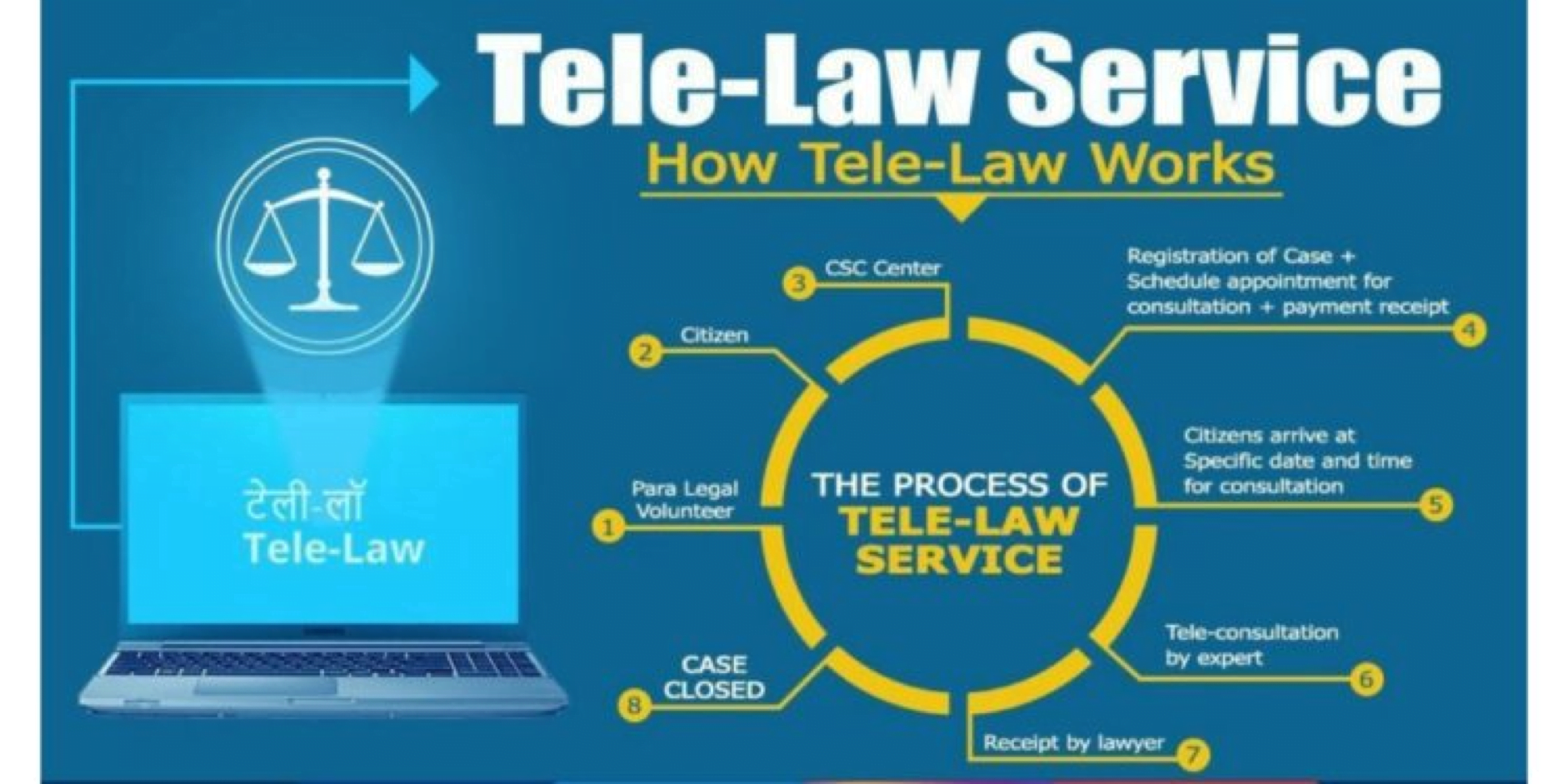
About Tele-Law
It was launched by the Ministry of Law and Justice in collaboration with the Ministry of Electronics and Information Technology (MeitY) in 2017 to address cases at the pre–litigation stage.
It is presently operating in 633 districts (including 115 Aspirational Districts) across 34 States/UTs through a network of 50,000 CSCs.
Under this programme, smart technology of video conferencing, telephone/instant calling facilities available at the vast network of CSC.
It enables anyone to seek legal advice without wasting precious time and money.
The service is free for those who are eligible for free legal Aid as mentioned under Section 12 of the Legal Services Authority Act, 1987. For all others a nominal fee is charged
This is useful for weaker & vulnerable sections of society to gain access to justice.
Even though the Tele-law programme is technology driven, its success is dependent on the working of field functionaries comprising Village Level Entrepreneurs (VLEs), Para Legal Volunteers (PLVs), State Coordinators and Panel Lawyers.