Geography
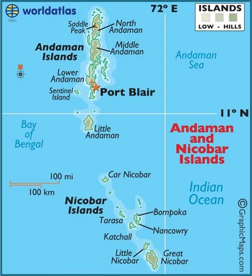
In News: NASA highlights loss of mangrove cover on Katchal island in the Nicobars.
- More than 90% of mangrove cover on the island was lost due to the Indian Ocean Tsunami.
- After the magnitude-9.2 Aceh-Andaman earthquake in December 2004, the islands experienced up to 3 meters (10 feet) of land subsidence.
- This submerged many mangrove ecosystems, resulting in a loss of more than 90 percent of mangrove extent in some areas.
- The mangrove cover on Katchal will not come back, as it lacks propagules.
- A propagule is a vegetative structure that can become detached from a plant and give rise to a new plant. Examples include a bud, sucker, or spore.

Source: Downtoearth.org
Previous Year Questions
Q.1) Consider the following statements: (2018)
- The Barren Island volcano is an active volcano located in the Indian territory.
- Barren Island lies about 140 km east of Great Nicobar.
- The last time the Barren Island volcano erupted was in 1991 and it has remained inactive since then.
Which of the statements given above is/are correct?
- 1 only
- 2 and 3
- 3 only
- 1 and 3
Q.2) Which one of the following statements best reflects the issue with Senkaku Islands, sometimes mentioned in the news? (2022)
- It is generally believed that they are artificial islands made by a country around South China Sea.
- China and Japan engage in maritime disputes over these islands in East China Sea.
- A permanent American military base has been set up there to help Taiwan to increase its defence capabilities.
- Though International Court of Justice declared them as no man’s land, some South-East Asian countries claim them.


